

Ad Hoc 3D solutions
People
Ad Hoc 3D is an highly specialized company founded by PhDs in the fields of Geomatics, Surveying and Design at the Polytechnic of Turin and Milan. In 2014 it incorporated SIR srl, the first italian geomatics spin-off (2006)
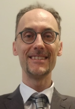
Eros Agosto
Environmental Engineer, PhD in Design and Survey for the protection of heritage buildings and land at the Politecnico di Torino.
Expert architectural survey, GPS positioning and open source information systems. Expert in GIS for ITHACA - Information Technology for Humanitarian Assistance, Cooperation and Action.
![]()
![]()
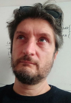
Paolo Ardissone
Graduated in Ancient Letters - archaeological studies at the University of Turin, PhD in Design and Survey for the protection of heritage buildings and land at the Politecnico di Torino.
Expert in the field of archaeological survey, excavation of document management, database design and GIS. He worked for years with The Center for Archaeological Research and Excavations in the Middle East and Asia in Turin for the missions in Iran.
![]()
![]()
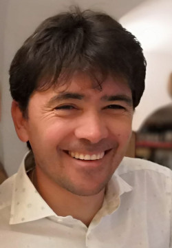
Leandro Bornaz
Civil Engineer at the Politecnico di Torino, PhD in geodesy and geomatics at the Politecnico di Milano.
Expert in design, detection and processing of terrestrial and aerial laser scanner data. Expert photogrammetric survey, data integration and management. In 2005 he received the national award Autec (Associazione Universitari di Topografia e Cartografia) as best research work in Italy in the field of geomatics with the doctoral thesis entitled L'analisi ed il trattamento dei dati laser scanner terrestri.
![]()
![]()
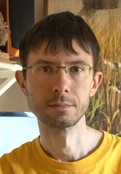
Fabio Dago
Computer Engineer, graduated from the Politecnico di Torino.
Expert computer systems, software development and IT solutions in C++, OpenGL. Is specialized in developing software tools for laser scanner data processing and management, GIS and 3D photo-interpretation.
![]()
![]()
External partners
By offering its services to various sectors, Ad Hoc 3D uses freelancers from highly specialized professional profile.